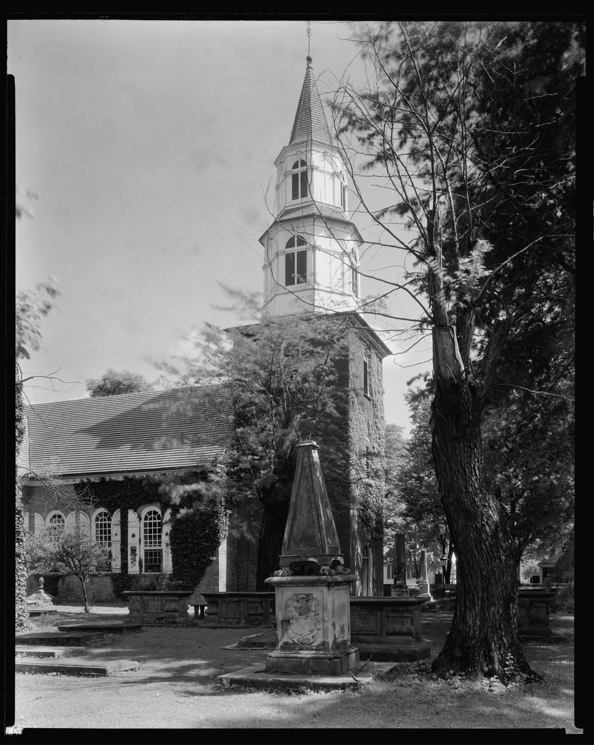
Readers of these posts doubtlessly know that burying grounds, whether ancient churchyards or park-like cemeteries, can be fascinating designed landscapes to visit and are often good places to find unusual and/or rare plants. The upcoming April 2026 Williamsburg annual meeting will allow those so inclined to walk about a compelling example at Bruton Parish Church. Set at the corner of Duke of Gloucester and Palace Green Streets, it was also visited by many members during our 1994 annual meeting.
There they found stout brick surrounding walls in place since the mid-eighteenth century and a bury ground containing an especially fine collection of table tombs. As tour guides explain, many wealthy early Virginians chose interment on their plantation, but for varying reasons others followed tradition and were buried under the church floor or in the bordering graveyard. Their markers, in turn, are often highly detailed, skillfully crafted, and clearly expensive displays of their wealth and social position.*
The church there today, designed by Governor Alexander Spotswood and dating to 1715, is the second house of worship on this site, replacing a 1683, less substantial, facility. Prior to the American Revolution, this solidly built Church of England sanctuary joined the nearby Governor’s residence as being important pillars of Royal Government authority. (Readers will recall that since the reign of Henry VIII the monarch was the official head of the Anglican Church, while bishops joined other lofty figures serving in the House of Lords. Colonial vestries also had powers that extended well beyond those of post-Revolution lay Episcopal governing groups.)
The churchyard, however, predates the 1715 sanctuary, the earliest identified grave (though not the first burial) being that of Thomas Ludwell, secretary to Governor William Berkeley who died in 1678. Many later parishioners, some wealthy, some poor, would follow Ludwell over coming years, the condition of this holy ground being marked by periods of decline and recovery. The Civil War years, for example, brought hard moments, especially during the 1862 Battle of Williamsburg, when the church saw use as a hospital and even the table tombs outside may have been pressed into service as operating platforms. A number of Southern soldiers who did not survive thus found their last resting place here as well.
While this continues to be an active Episcopal Church it may come as a surprise that the grounds have also been a Garden Club of Virginia (GCV) project site since before World War II. The first GCV involvement began 1936-37 with limited tree and shrub installation. Several years later, however, heavy pedestrian pressure led famed Colonial Williamsburg (CWF) and GCV landscape architect Arthur Shurcliff to develop renovation plans for the churchyard featuring improved visitor-access installations, especially brick walks. Approved by GCV, the Bruton Parish vestry, and CWF leadership, actual site work had to wait until the 1950s, with then CWF and GCV landscape architect Alden Hopkins making plan adjustments prior to implementation.
Despite these improvements, however, by the late 1990s the churchyard was in “a sorry state,” to quote GCV historian Margaret Page Bemiss.** The situation, which reflected continuing large-scale foot traffic, demanded more than a band-aid approach, circumstances that would be addressed in 2000 by Will Rieley who had recently stepped in as GCV landscape architect. (A former SGHS board member, he is scheduled to speak at the April 2026 Williamsburg annual meeting.)
Rieley thus teamed with church leaders and CWF staff members to revamp the Shurcliff-Hopkins designs by expanding the brick paved area. Old bricks were thus removed and then underlain with concrete, while site drainage was greatly improved. Rieley’s plan, moreover, separated the bricked pedestrian space and sanctuary from the rest of the site by a single-rail iron fence. This, in turn, provided two openings on the west and two on the north allowing access to paths that wind among burial sites. Other features included a columbarium set in the very southwest churchyard corner and a stone outline of the brick church which preceded the existing 1715 building. The plan also called for replacement of dead or dying plants with native species or other plants present here during the colonial and early national periods…a good opportunity to use the Southern Plant Lists found on the SGHS website.
This writer, for one, is looking forward to an April 2026 visit to see how GCV’s plan is holding up over a period of several decades and perhaps to have a chat with Will Rieley himself to gain even further insight.
**********************************************************
*For greater detail, including illustrations, see A Guide to the Memorials at Bruton Parish Church, available online at: https://heritagecenter.brutonparish.org/book/guide-memorials-bruton-parish-church.
** Margaret Page Bemiss, Historic Virginia Gardens: Preservation Work of the Garden Club of Virginia, 1975-2007, “Bruton Parish Churchyard.”
Leave a Reply